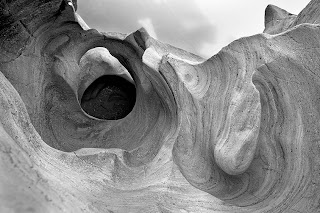
Standing in an unseen footprint of a man I will never know. The visibility up and down the canyon is awe-inspiring. The unheard has undoubtedly felt the warmth of the sun, as it crests the lava cliff on the opposite shore of the river. Nameless heartbeats in the form of the sun spreads across the desert floor casting subtle pattern in the fragile chalk cliffs of the basin. The Owyhee River Canyon, one of America's newest wilderness areas.
There is not much that compares. The Owyhee rivals the Grand Canyon in distance. Stretching from the Northern edge of Nevada at it highest point, the river flows north west through the the south western corner of Idaho, then into Oregon and on to it confluence with the Snake River. This is one of America's most rugged, and least known Wilderness Areas.
William Fox, from the book, "Owyhee Canyonlands" writes.
"The region where Nevada, Oregon, and Idaho conjoin--not abut, but conjoin, as in combining into one another to form a unique region--is off the map. That is, it commonly takes three road maps to capture some sense of where you are. "Some sense," as in not all, as the three states represented are of widely differing sizes and shapes, yet have to be crammed onto sheets of standard-sized map paper. There's nothing you can do with scissors and tape to fix it,either: the maps are all of different scales, so the edges never match up. All this just to put together a schematic of the Owyhee Canyonlands, the deeply riven sage brush-steppe that is one of the largest roadless areas in the lower Forty-eight. That means you can fly over it, walk into it, and in some cases float through parts of it--but you can't drive into much of it. This is a good thing."


.jpg)


